mapshaper - Working with South Korea's Administrative District (Haengjeong-dong) Map Data
Map data and visualization
2024.10.01 - [JS,Node,React] - Map visualization with React and D3.js
I covered map data a bit last time.
Let’s dig a little deeper into the mapshaper commands for getting the map data you want.
https://github.com/vuski/admdongkor
Grab the GeoJSON for South Korea’s administrative districts (haengjeong-dong) here,
then use the mapShaper web console to type in commands and shape the map data however you need.
mapshaper
1
2
3
4
5
6
7
8
9
10
11
12
13
14
15
16
17
18
19
20
21
22
23
24
25
26
27
28
29
30
31
32
33
34
35
36
37
38
39
40
41
42
43
44
45
46
47
48
49
50
51
52
53
54
55
56
57
58
59
60
61
62
63
64
65
66
67
68
69
70
71
72
73
74
75
76
77
78
79
80
81
82
83
84
85
86
87
$ -help
Usage:  mapshaper -<command> [options] ...

I/O commands
-i               input one or more files
-o               output edited content

Editing commands
-affine          transform coordinates by shifting, scaling and rotating
-classify        assign colors or values using one of several methods
-clean           fixes geometry issues, such as polygon overlaps and gaps
-clip            use a polygon layer to clip another layer
-colorizer       define a function to convert data values to color classes
-dashlines       split lines into sections, with or without a gap
-dissolve        merge features within a layer
-dissolve2       merge adjacent polygons (repairs overlaps and gaps)
-divide          divide lines by polygons, copy polygon data to lines
-dots            fill polygons with dots of one or more colors
-drop            delete layer(s) or elements within the target layer(s)
-each            create/update/delete data fields using a JS expression
-erase           use a polygon layer to erase another layer
-explode         divide multi-part features into single-part features
-filter          delete features using a JS expression
-filter-fields   retain a subset of data fields
-filter-islands  remove small detached polygon rings (islands)
-filter-slivers  remove small polygon rings
-graticule       create a graticule layer
-grid            create a grid of square or hexagonal polygons
-include         import JS data and functions for use in JS expressions
-inlay           inscribe a polygon layer inside another polygon layer
-innerlines      convert polygons to polylines along shared edges
-join            join data records from a file or layer to a layer
-lines           convert a polygon or point layer to a polyline layer
-merge-layers    merge multiple layers into as few layers as possible
-mosaic          convert a polygon layer with overlaps into a flat mosaic
-point-grid      create a rectangular grid of points
-points          create a point layer from a different layer type
-polygons        convert polylines to polygons
-proj            project your data (using Proj.4)
-rectangle       create a rectangle from a bbox or target layer
-rectangles      create a rectangle for each feature in a layer
-rename-fields   rename data fields
-rename-layers   assign new names to layers
-simplify        simplify the geometry of polygon and polyline features
-snap            snap together nearby vertices
-sort            sort features using a JS expression
-split           split a layer into single-feature or multi-feature layers
-split-on-grid   split features into separate layers using a grid
-style           set SVG style properties using JS or literal values
-symbols         symbolize points as arrows, circles, stars, polygons, etc.
-target          set active layer (or layers)
-union           create a flat mosaic from two or more polygon layers
-uniq            delete features with the same id as a previous feature

Experimental commands (may give unexpected results)
-cluster         group polygons into compact clusters
-data-fill       fill in missing values in a polygon layer
-frame           create a rectangular map frame layer at a given display width
-fuzzy-join      join points to polygons, with data fill and fuzzy match
-require         require a Node module or ES module to use in JS expressions
-run             create commands on-the-fly and run them
-scalebar        add a simple scale bar to SVG output
-shape           create a polyline or polygon from coordinates
-subdivide       recursively split a layer using a JS expression

Control flow commands
-if              run the following commands if a condition is met
-elif            test an alternate condition; used after -if
-else            run commands if all preceding -if/-elif conditions are false
-endif           mark the end of an -if sequence
-stop            stop processing (skip remaining commands)

Informational commands
-calc            calculate statistics about the features in a layer
-colors          print list of color scheme names
-comment         add a comment to the sequence of commands
-encodings       print list of supported text encodings (for .dbf import)
-help, -h        print help; takes optional command name
-info            print information about data layers
-inspect         print information about a feature
-print           print a message to stdout
-projections     print list of supported projections
-quiet           inhibit console messages
-verbose         print verbose processing messages
-version, -v     print mapshaper version

Enter mapshaper -help <command> to view options for a single command
There are quite a few commands available. Let’s look at a handful of them.
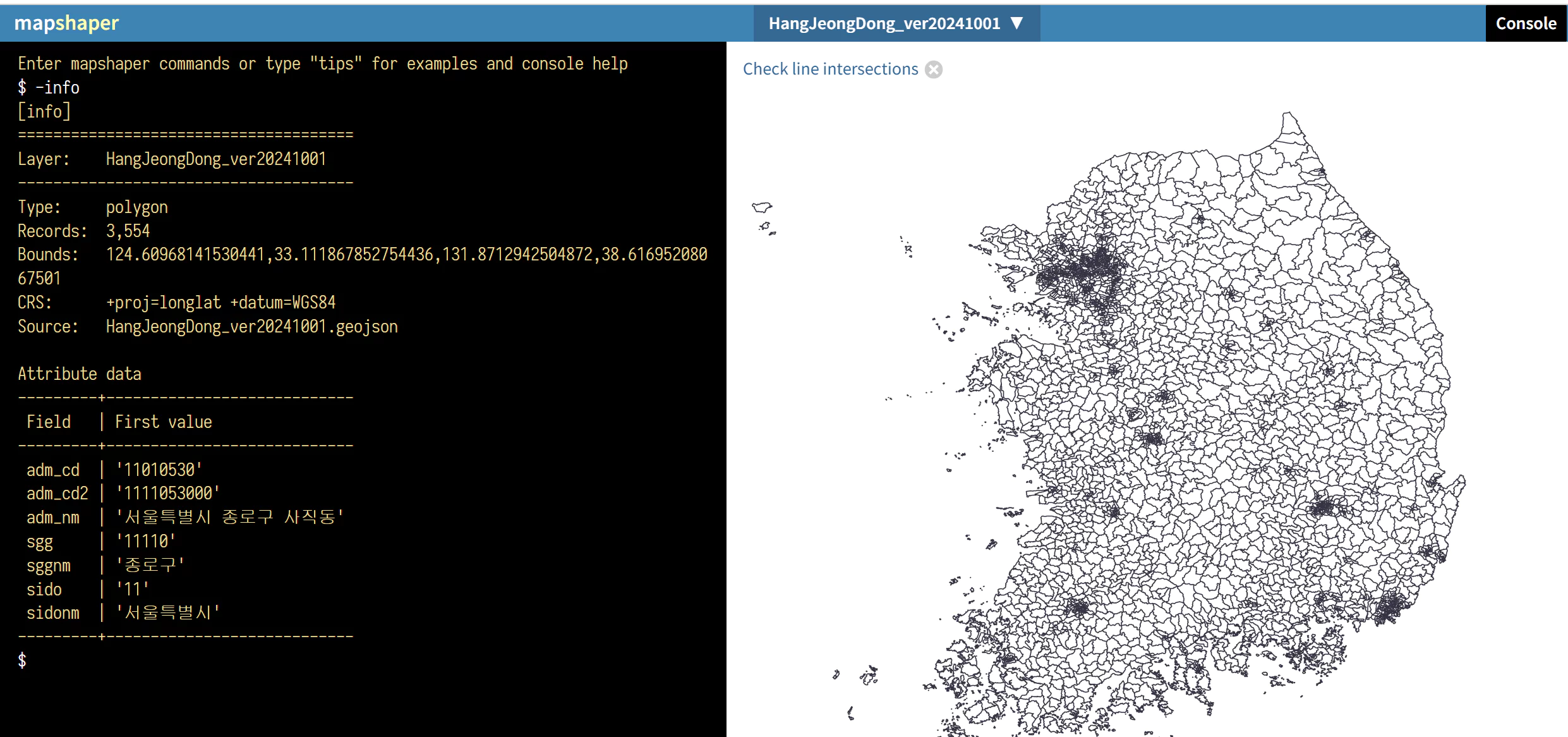 -info
-info
The console is in the upper right corner.
-info shows information about the .geojson file, along with the key-value pairs of one sample data field.
A “field” here refers to a key inside the properties object.
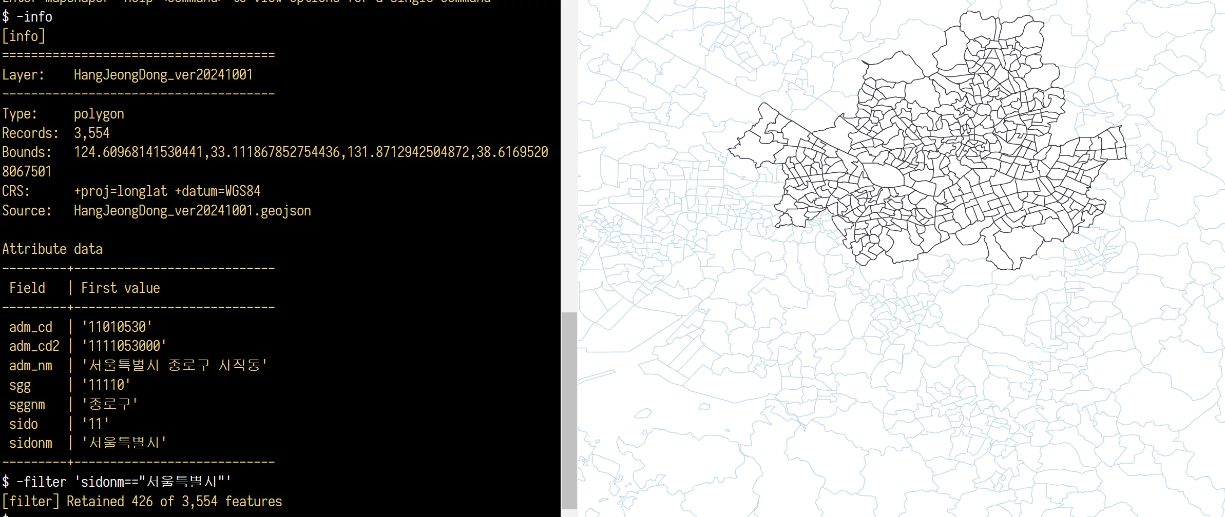 -filter
-filter: lets you search using field values as conditions.
Out of 3,554 features, 426 remain. If you export at this point, only the filtered data gets exported.
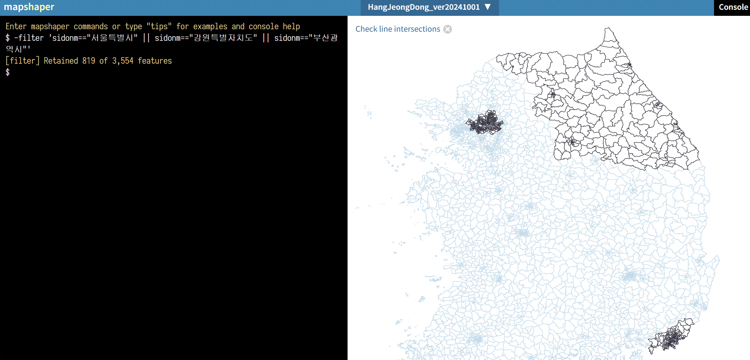 -filter ❘❘ condition
You can use conditional expressions.
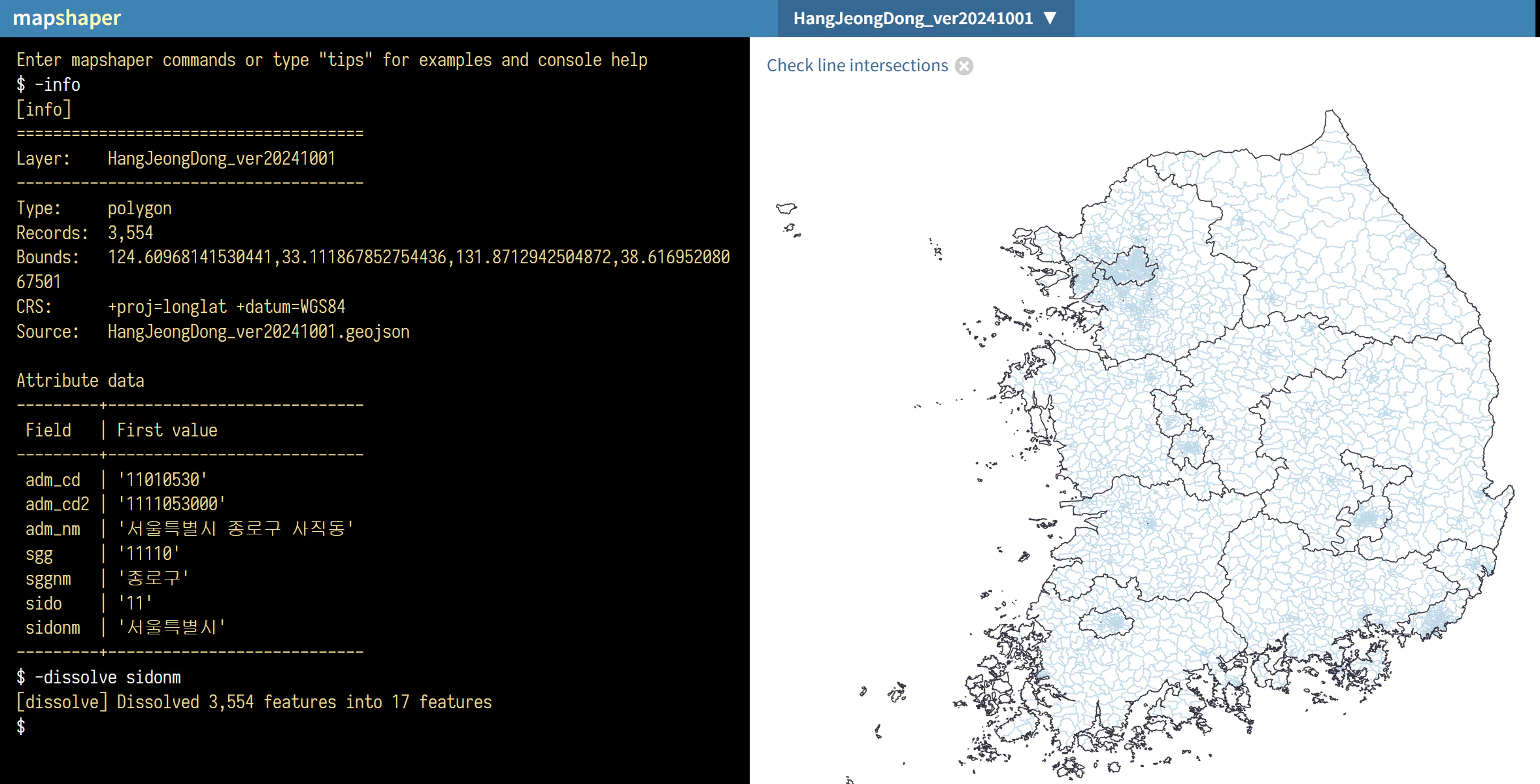 -dissolve
-dissolve: merge features within a layer — lets you merge layers together.
Using -dissolve <property> merges features based on that property, leaving only 17 features.
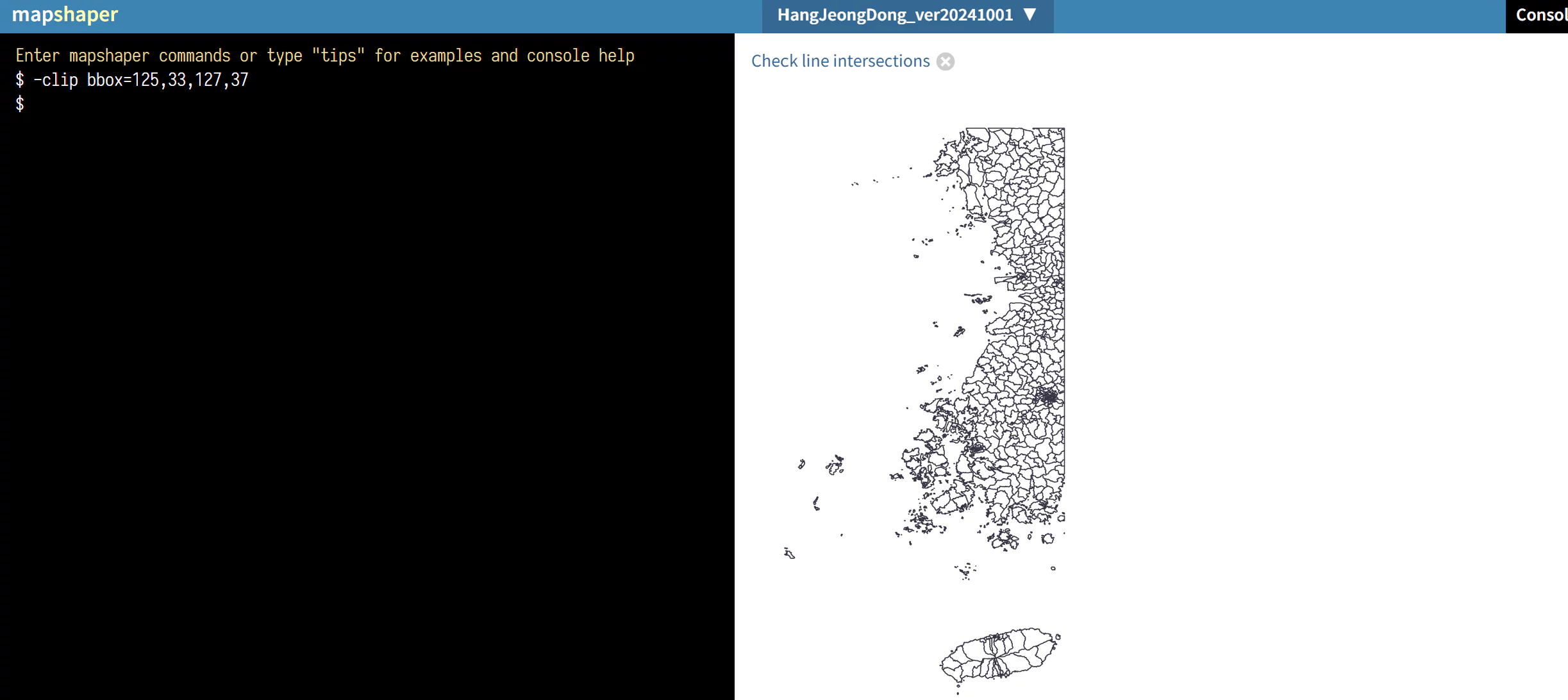 -clip
-clip
-clip: keeps only the data within a specified boundary.
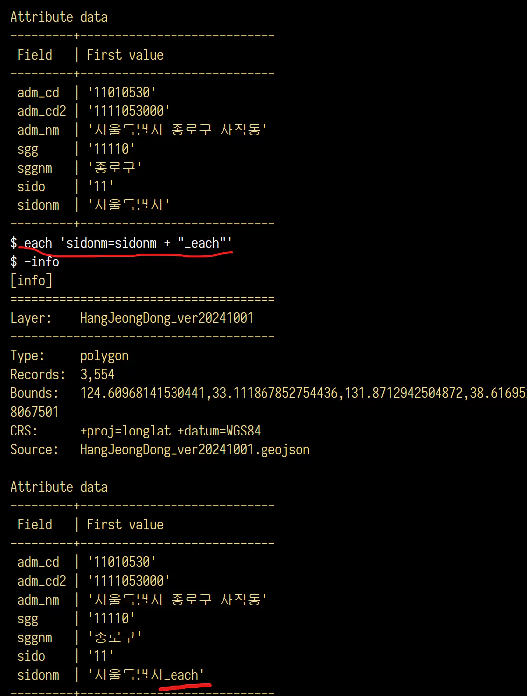 -each
-each
-each: create/update/delete data fields using a JS expression
It seems you can use this to add new fields, modify existing field values, and do all sorts of other things.
Looking back at the -help output from earlier, there are many more commands available.
If a single map data file (geojson, shapefile, topojson, etc.) is too limiting on its own, you can join and work with multiple files together.
If you need more complex commands, or the web console feels inconvenient, install mapshaper via Node and use it locally instead.